 |
Sevenoaks & Ide Hill MAPS HEIGHTS CLOG Walk: 9th April 2017 |
|
| Where ? Map Heights Figures Extra Timing Track Finally Read Me |

Features of Our Walk
On our circular walk of about 11¼ miles or just over 18 Km we explored the gently undulating landscape of the Kentish countryside west of Sevenoaks Station (station code: SEV), with the Cock Inn at Ide Hill our lunch time aim. In the afternoon we enjoyed views to the south, including Bough Beech Reservoir. It was spring, and the trees were turning delicate shades of green. We also enjoyed ideal walking weather: sunshine and a maximum temperature of about 22°C. It was a relaxed and enjoyable walk.
From above the Hanging Bank we enjoy views to the south.
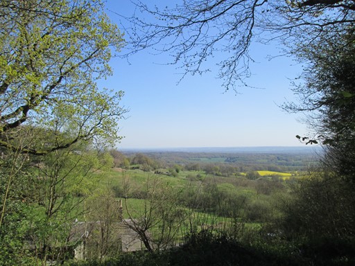
Bough Green Reservoir will soon appear on the left.
Now prepare ye for some plots and graphs. Not too overwhelming, but hopefully quite interesting! You will see here:
- An Outline Map of Our Walk
- Height Profile of Our Walk
- Some Facts and Figures
- Extra, Less Quantifiable, Considerations
- Timing & Speed
- Track File
- And Finally
How far were we from the Centre of London?
Our circular walk was based at Sevenoaks Station (SEV) which is about 20¾ mile (33½ Km) south east of the centre of London. The Centre of London is officially taken as the intersection of The Strand, Whitehall and Cockspur Street, and is on the south east edge of Trafalgar Square. This three-way intersection is often referred to as Charing Cross, not to be confused with the nearby Victorian Eleanor Cross itself, nor the station in front of which the cross stands. The detailed figures, for the fun of it, are as shown below.

Sevenoaks Station is about 21 miles south east of the centre of London.
Our "straight line" distances are actually "great circle" distances on the earth's surface. To calculate these, we assume here that the earth is spherical, which is not far off the mark. Assuming the earth to be a sphere gives us a maximum error of about 0.1% in our distance values. Not that much really! Can't complain! Indeed, we can speak of the distances as the "hypothetical crow" (cornix hypothetica) flies.

Cornix Hypothetica, our hypothetical crow,
isn't any old bird, as we should know.
Cornix Hypothetica! Many miles for us you go,
with many a "straight line" o'er Earth to show.
If you would like to inject a little more detail into our discussion, we use the
"WGS84"
system, noting that the
GPS coordinates of the Centre of London are: latitude 51.507300°N and longitude -0.127550°E, and for Sevenoaks Station they are: latitude 51.276986°N and longitude 0.182502°E. We assume that the earth - instead of being an ellipsoid - is, for simplicity, a sphere with a volumetric mean radius of 6371.0088 Km. This enables us to find conveniently the shortest distance - as the crow flies - between the two points. This distance is along the circumference of the
"great circle"
passing through our points of interest, namely, Sevenoaks Station and the Centre of London. To find this distance, we use a bit of trig from our school days - a nice little dose of sines and cosines, although still easier than working with an ellipsoid. Who says that trig is boring?
Of course, we are normally earth-bound, and so we must usually navigate bumps and detours in the landscape. This is fun when out walking, but adds some extra miles in addition to our "shortest distance" when we travel across the landscape by any combination of road, rail, canal (?!?) and "foot-power".

Our walk was just outside the M25 and within 21 miles of the centre of London
(the 3-way road meeting point of Charing X). The scales on the above map are
Longitude: -3.0° to +2.0° and Latitude: 50.0° to 53.5°.
Outline Map of Our Walk
Our walk was topologically circular, starting and finishing at Sevenoaks Station (SEV). Here we look at (a) the map grid scales (Km per 0.01° longitude and latitude) and (b) map distortion due to mapping the surface of part of a sphere on to a flat plane (our folding OS® map!). The plot for the walk was obtained using my Garmin® sat nav.

Outline Map of Our Walk
Y and X axes are in degrees latitude and longitude respectively.
Map Scales Here are few numbers. The minus signs for the longitude angles indicate "degrees west of Greenwich". The map grid scales translate to 1.112 Km per 0.01° latitude and a mean of 0.696 Km per 0.01° longitude, all when using 6371.0 Km as the volumetric mean radius of the earth - as per the WGS84 standard! It is interesting to compare the present longitude distance-to-degree ratio with that for other walks. It you do this, you will see that the further north you go, the less Km per degree longitude you get. Once you get to the Lake District the reduction in this ratio compared to that for walks in the south-east is quite noticeable. In Scales, in the Lake District, we already have a slightly smaller value of 0.644 Km per 0.01° longitude - a difference of 52 metres per 0.01° longitude compared with our present Berkshire walk.
Map Distortion. Because we don't live on a flat earth - unless you are a convinced "flat earther" - maps are inevitably a distortion of what is. In other words, it's all a matter of mapping a curvaceous surface onto a flat surface. We don't want to carry curvaceous representations of the terrain on our walks, do we? In our case, the northern length of our map grid is stretched out by an extra 0.09 %, to make it the same on the page as the length of the southern part of our map grid. Not that much for hiking purposes really! Can't complain.
Height Profile of Our Walk
This height profile emphasises that the height of our lunch time stop in Ide Hill was just a tad short of being the highest point on our walk. Indeed, St Mary's at Ide Hill, at 216 metres above sea level, is the highest church in Kent. Therefore, in the morning we had an ascent, punctuated by a few ups and downs. Correspondingly, in the afternoon, we had a reasonably steady descent. In this context, remember that the Ordnance Survey® in Great Britain uses the "Ordnance Datum Newlyn" (Newlyn as in Cornwall).

Height Profile
Vertical Axis is in metres. Horizontal axis is in Km.
To maintain realism, the height on the vertical axis starts at 0 metres above sea level.
Some Facts and Figures
Here are some "vital statistics" in metric and imperial units. Start and end elevations are the same for obvious reasons! Of course, the total ascent (here 383 m) usually exceeds the difference between maximum and minimum elevations (here (217 - 93) m or 124 m); I'd suspect things, if the reverse transpired! The total distance, as always measured on a conceptual "flat" plane at mean sea level, is 11.28 miles or 18.15 Km.

"Walk facts and figures"
Extra, Less Quantifiable, Considerations
On any walk there are considerations which are very real but tantalizingly out of ready reach of those who wish to espouse a numerical approach to many of life's activities. Here are three considerations for starters.
- Weather: From the pictures we can see that we had good weather for walking. This is borne out by the table below, whose figures were derived from the "Accuweather" website.
- Ground Conditions: There was no mud.
- Signposting: The paths were adequately signposted, but it is of course always a good idea for walk participants to bring their own map.

"Weather for 8, 9, 10 April 2017"
Timing and Speed
It's one thing to discuss the terrain over which we walk. It's quite another to ask how we personally respond to walking over that terrain. There are a number of considerations, of which timing and speed can be taken as starting points.
- Timing: The actual walk took about 4½ hours excluding lunch and snack stops.
- Speed: In addition, the walk was about 11¼ miles. This gave an average speed of about 2½ mph, which is acceptable given the undulating terrain in this part of the world.

"Walk Timing"

Track File
If you are keen to see our walk superimposed on an Ordnance Survey® (OS) map, then you can use the following file to do so. As mentioned above, the numerical data in this file are based on "WGS84" and were recorded on my GPS (Garmin®). Of course, for copyright reasons, I do not show the OS-based map here. Furthermore, the plot may also include some walkabouts in hostelries and sightseeing places; hence there may be a slight over estimation of the length by perhaps 0.5 Km. However, the important thing is that for you, the reader, there is a record of the paths we chose for our walk, so that you could repeat the walk if you wish.
Sevenoaks and Ide Hill Circular
And Finally - a Matter of Practicality
Any map is an approximate representation of what is. Practicality and scale are relevant considerations. We are not dealing with a planning application calling for detailed spatial descriptions of intricate boundaries. For us in the hiking community, the degrees of accuracy and precision should be just enough to give us useable and helpful knowledge of the terrain about us and beneath our feet. I hope my humble endeavours on this page are in this respect interesting for, and useful to, you my reader!
Eric Scharf
Original: 2020-10-28 @11:06
SAGAX REX HANC RETIS ORBIS PAGINAM PINXIT ANNO MMXX.
© Eric Scharf 2020